Google has introduced a new AI model called AlphaEarth Foundations that it says can function like a "virtual satellite." The model uses a system called "embedding," which works by taking big volumes of pubic information from various sources every day, such as optical satellites, radars and climate simulations, and then combining them all together. It then divides lands and coastal waters into 10x10 meter squares, which it then analyzes and tracks over time. As Wired explains, these squares are color-coded to indicate different characteristics, such as vegetation types and material properties.
The company said AlphaEarth Foundations makes its data easy to use by creating what it calls "highly compact summary" for each square of land or coastal water it monitors. These compact summaries apparently need 16 times less storage compared to those produced by comparable AI systems, thereby reducing costs needed for Earth observation.
So what exactly can the model's data be used for? Google explained that scientists can use the model to create detailed maps on demand for multiple purposes, such as to monitor crop health or to track deforestation. In its announcement, the company claimed that the model excelled at a wide range of tasks over different time periods when it was tested. "AlphaEarth Foundations represents a significant step forward in understanding the state and dynamics of our changing planet," Google wrote. The company gave over 50 organizations access to the model's Satellite Embedding dataset, a collection of its annual embeddings, to test its use in real world applications over the past year. Now, it has released the dataset in Google Earth Engine so that other scientists can use it for their own research.
This article originally appeared on Engadget at https://www.engadget.com/ai/googles-virtual-satellite-ai-model-can-provide-a-near-real-time-view-of-earth-133055880.html?src=rss https://www.engadget.com/ai/googles-virtual-satellite-ai-model-can-provide-a-near-real-time-view-of-earth-133055880.html?src=rssConnectez-vous pour ajouter un commentaire
Autres messages de ce groupe
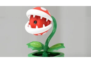
Even though the Switch 2 basically just came out, we're already starting to see discounts on some of its accessories. One of the more charming peripherals, the HORI Piranha Plant camera, is on sale

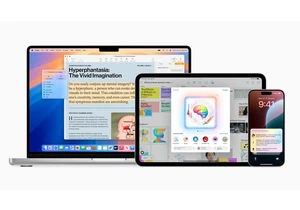
If you've put off getting a new MacBook then today is your lucky day. Right now, the 2025 13- and 15-inch MacBook Air M4 are available on Amazon for record-low prices. The 13-inch model is our pick


X isn't off the hook yet when it comes to a significant legal case about child sex abuse content on its platform. On Friday, a circuit judge from the US Court of Appeals ruled that X Corp. has to a

YouTube has started testing a